Welcome
This page is under development. More information will be listed soon! To find a list of public datasets and publications, please see the “Published Reports and Datasets” tab above.
Current Data Pages
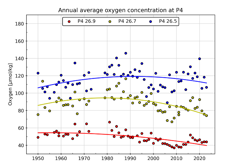
New!📣 Line P Dissolved Oxygen Monitoring
- Dissolved oxygen plots from stations of the Line P long-term monitoring program.
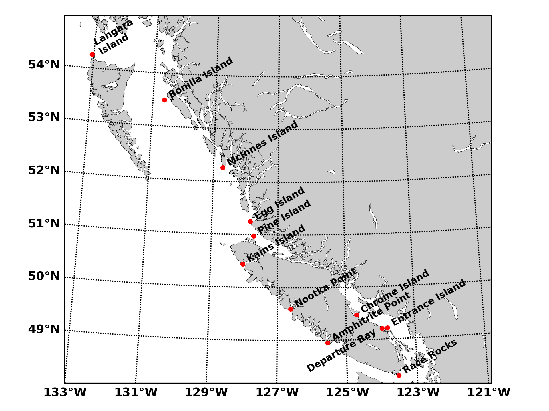
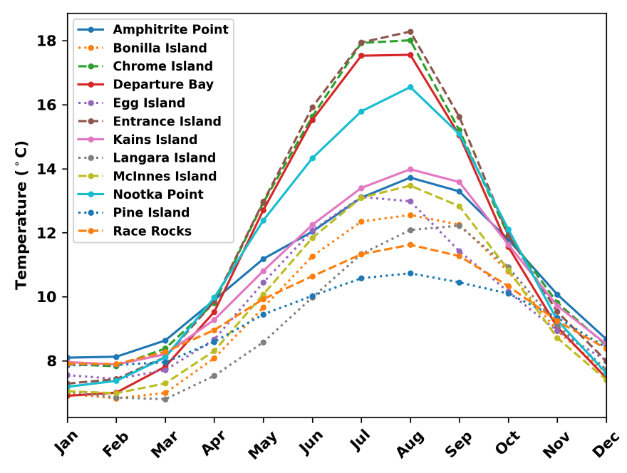
B.C. Lightstation Sea-Surface Temperature
- Observational data, trends and climatologies of SST and salinity from B.C. Lightstations. Daily observations extend as far back as 1914.
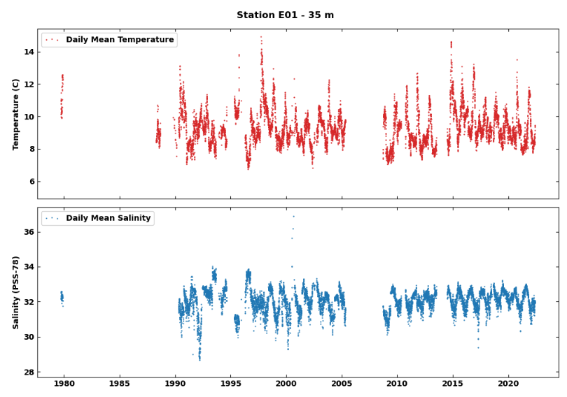
Ocean Sciences Division Mooring Data
- Time series of temperature and salinity from mooring stations on the west coast of British Columbia.
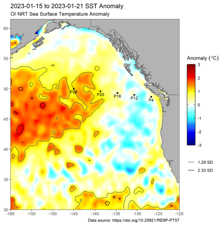
Marine Heatwave Monitoring of the Northeast Pacific
- Satellite SST maps, anomalies, and buoy time series of the Northeast Pacific for tracking marine heatwaves.
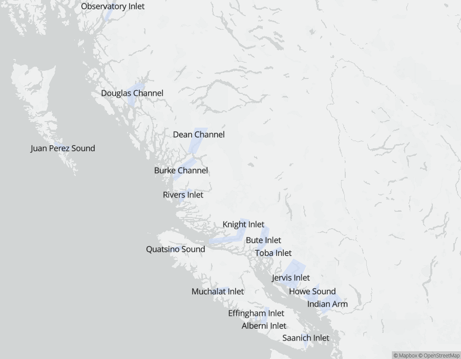
Deep Water Properties of B.C. Inlets
- Deep water properties, physical descriptions, and monitoring data for major inlets of British Columbia from the Water Properties database, CIOOS Pacific and Hakai Institute. Summaries include monthly and annual statistics and time series of samples back to the 1930’s.
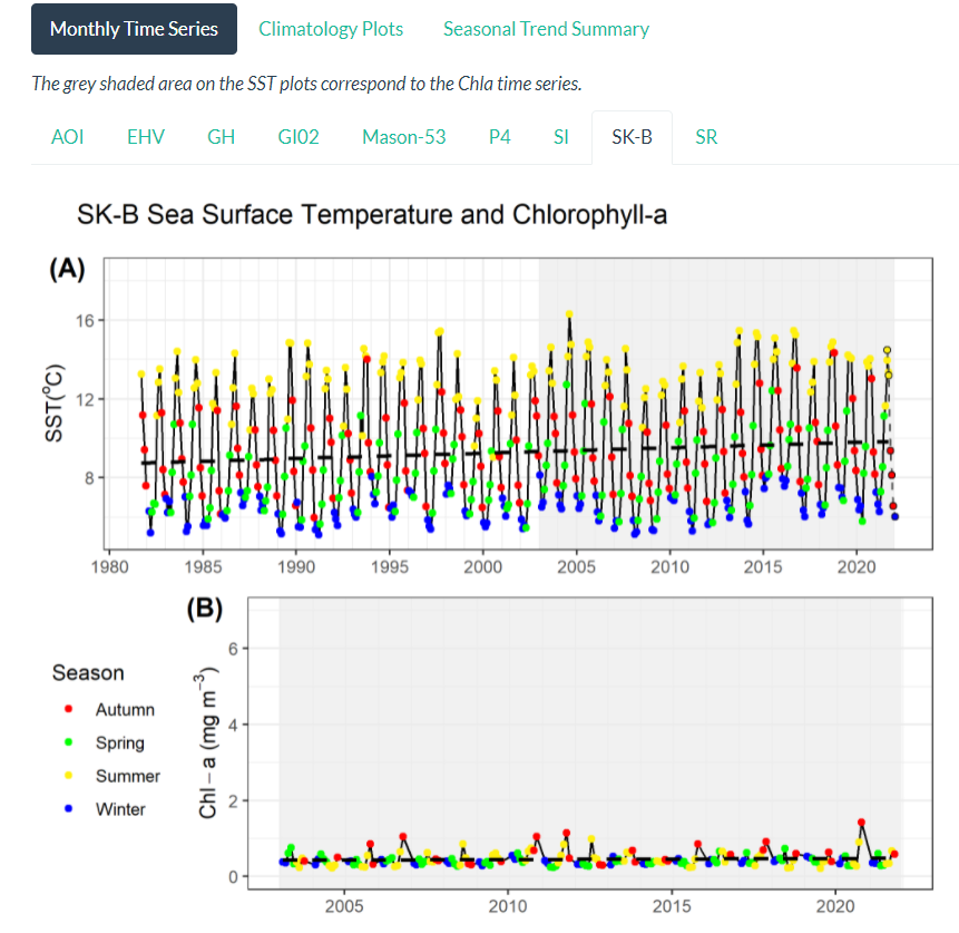
Satellite Sea-Surface Temperature and Chlorophyll-a Concentration Time Series
- Satellite time series of surface waters from Pacific Marine Protected Areas and regions of interest, spanning 1981-2022.